Your competitors are saving $47,000 per project with one technology most contractors still haven’t adopted. Drone construction inspection has moved from novelty to economic necessity, and the math is no longer ambiguous. Every week you run traditional survey crews, you’re leaving five figures on the table across labor, safety liability, rework, and project closeout delays.
This isn’t about being early to technology. In 2026, this is a construction business growth decision with a documented payback window and measurable profit impact. Here’s exactly what the numbers look like.
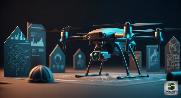
Key Takeaways
-
Drone inspections save $47,000 per project on average. Savings stack across labor reduction, rework prevention, insurance claims, and faster project closeouts—not from any single line item.
-
Initial investment runs $3,000–$15,000 and breaks even in 6–18 months. Most contractors recoup hardware and software costs within the first year based on labor savings alone, before accounting for safety or rework reductions.
-
On-site inspection time drops 40–60% with drone deployment. That freed crew time converts directly to billable hours on active projects, compressing schedules without adding headcount.
-
Rework costs fall 15–25% with high-resolution aerial data. Ground crews miss surface defects, drainage slope deviations, and framing alignment errors that drone imagery catches in a single pass.
-
One drone operator can cover multiple job sites in a single day. Traditional multi-crew inspections that take 2–3 days per site collapse to 2–4 hours of flight time and processing.
-
Drone data integration cuts admin time by 30%, per Smart Business Automator research. When aerial imagery feeds directly into project management platforms, punch list generation, progress reporting, and client presentations happen in hours, not days.
-
FAA Part 107 certification is the compliance baseline—and skipping it voids your insurance. Operating commercially without proper certification exposes contractors to $27,500+ in FAA civil penalties per violation and invalidates liability coverage.
Drone Inspections vs. Traditional Surveys: Breaking Down Contractor Profit Margins in 2026
The cost difference between traditional site surveys and drone inspections is not incremental—it’s structural. Traditional surveys price out at $800–$2,000 per site visit when you factor in crew time, equipment, travel, and processing. Drone inspections run $300–$800 for equivalent or superior coverage. On a 30-project year, that spread alone generates $15,000–$36,000 in direct cost savings before you touch labor, rework, or insurance.
The full $47,000 per-project savings figure accounts for four compounding factors:
-
Direct survey cost reduction: $500–$1,200 per project from lower inspection costs
-
Labor redirection: Freed crew hours reallocated to billable work, valued at prevailing wage rates ($35–$85/hour depending on trade and jurisdiction)
-
Rework avoidance: Catching defects aerially before they compound—a single missed foundation drainage issue can cost $8,000–$40,000 in remediation
-
Faster closeouts: High-resolution documentation accelerates punch list resolution and retainage release by 10–21 days on average
For contractors focused on construction cash flow management, that last point matters enormously. Retainage typically runs 5–10% of contract value. On a $2M project, releasing $100,000–$200,000 in retained funds three weeks earlier is a cash flow event that compounds across a portfolio.
Hardware costs are a one-time capital expense. Entry-level commercial drones with mapping capability run $3,000–$6,000. Mid-tier systems with thermal imaging and LiDAR integration range $8,000–$15,000. Software subscriptions—data processing platforms like Pix4D or DroneDeploy—add $2,000–$6,000 annually. Total year-one investment: $5,000–$21,000. At $1,200 in savings per project, a 10-project quarter pays for the hardware entirely.
For smaller contractors watching every dollar, equipment leasing and third-party drone service providers eliminate upfront capital requirements. Many regions now have commercial drone operators who price per-flight at $400–$900—still below traditional survey costs—while you evaluate whether in-house capability makes sense at your project volume.
How Drone Technology Is Fueling Construction Business Growth in 2026
The contractors scaling fastest in 2026 aren’t just using drones to cut costs. They’re using drone data as a business development asset. High-resolution aerial documentation changes the client conversation before a contract is signed and after it closes.
Pre-bid advantage: Contractors who show up to bid presentations with aerial survey data of the site—captured in a 2-hour flyover before the RFP deadline—demonstrate operational sophistication that smaller competitors can’t match. Owners notice. Estimating accuracy improves when ground truth data replaces assumptions, and tighter bids win contracts with better margins.
The accuracy improvement directly affects construction estimating software outputs. When your takeoffs reference actual site conditions rather than 2D plan assumptions, change order frequency drops. Owners who’ve been burned by scope creep on prior projects pay attention to contractors with documented pre-construction surveys. That reputation compounds into repeat business and referral volume.
Progress documentation as a retention tool: Weekly aerial progress reports give owners visibility without requiring site visits. For commercial owners managing multiple properties, GCs who deliver professional aerial updates retain clients between projects because the relationship extends beyond punch list completion.
For anyone focused on scaling construction business past the $5M revenue threshold, drone capability signals operational maturity. General contractors bidding on larger public works projects increasingly ask subcontractors about technology infrastructure. Drone programs are part of that conversation.
According to Smart Business Automator’s market intelligence, contractors who integrate drone workflows into client-facing reporting see measurable improvements in contract renewal rates and referral velocity. The data creates touchpoints that keep your company visible to owners between project cycles—critical for construction companies where the sales cycle runs 6–18 months.
Competitive bid positioning: Drone-equipped contractors have submitted bids 8–12% below competitors while maintaining target margins, because their cost structure is genuinely lower. When your inspection costs drop by 60% and your rework budget tightens by 20%, you can sharpen the bid without cutting profit.
The Safety ROI Contractors Consistently Undervalue
Safety ROI is the most underestimated component of the $47,000 savings figure—and it’s the one with the largest tail risk if ignored. OSHA fall violations averaged $15,625 per citation in 2025, with willful violations reaching $156,259. Any inspection that removes a worker from a roof, scaffold, or elevated structure is a potential OSHA liability avoided.
Drone inspections eliminate human exposure in four specific high-risk scenarios:
-
Roof membrane and flashing inspections on commercial structures
-
Structural assessments on unstable or partially demolished buildings
-
Post-storm damage surveys on water-compromised structures
-
Bridge deck and overhead utility corridor evaluations
Insurance impact is direct and measurable. Experience Modification Rates (EMRs) drive your workers’ compensation premiums. A single lost-time injury claim can push an EMR above 1.0, triggering premium increases of 15–30% across your entire coverage portfolio. For a contractor paying $180,000 annually in workers’ comp, a 20% EMR spike costs $36,000—every year until the claim ages off the three-year calculation window.
Drone inspections don’t just prevent injuries. They create documentation that defends against fraudulent or inflated claims. When every site condition is photographed from multiple angles before and during work, disputed liability claims have an evidentiary baseline that adjusters can evaluate objectively.
Thermal imaging capability—available on mid-tier drone systems—adds moisture detection, insulation gap identification, and electrical hotspot documentation that ground inspection physically cannot replicate without destructive testing. Catching a moisture intrusion aerially before a wall is closed saves the cost of remediation (typically $4,000–$18,000 for mid-scale commercial work) and avoids the insurance claim entirely.
For context on how leading contractors in diverse market segments are approaching this, the work being done by women in construction who are building tech-forward operations from the ground up shows how safety infrastructure and technology adoption track together in high-growth firms.
AI Construction Technology 2026: Integrating Drone Data Into Your Workflow
Raw drone footage generates no ROI. The value is in processing speed, integration depth, and decision latency—how fast aerial data turns into action on the ground. This is where AI construction technology in 2026 separates contractors who generate efficiency from those who just own expensive hardware.
Modern drone platforms with AI processing capability can:
-
Generate orthomosaic maps and 3D point clouds within 2–4 hours of flight
-
Flag deviation from design spec automatically by comparing aerial scan data to BIM models
-
Produce progress percentage calculations across defined work zones without manual measurement
-
Identify surface defects, ponding risk areas, and material stockpile volumes with sub-inch accuracy
-
Auto-generate punch list items tied to GPS coordinates for field crew dispatch
Integration with construction project management software is where the admin time reduction materializes. Smart Business Automator’s automation research documents a 30% reduction in administrative hours when drone data feeds directly into project workflows rather than sitting in a separate folder waiting for manual entry. That 30% translates to 4–8 hours per project week for a PM managing three active sites—time that redirects to client communication, subcontractor coordination, and change order management.
For contractors invested in construction workflow automation, drone integration is the field data layer that makes office automation complete. Back-office systems can only automate what they can see. Aerial data gives them visibility into physical site conditions, not just financial and document workflows.
The data accuracy edge compounds across a project’s lifecycle. Contractors report 15–25% reductions in rework costs when high-resolution aerial imagery is part of the inspection cadence. At an industry average rework rate of 5–10% of project cost, preventing half that rework on a $1.5M project saves $37,500–$75,000—numbers that dwarf the annual cost of a drone program.
Construction project management workflows that incorporate aerial data also accelerate owner approval cycles. When progress is documented photographically at consistent intervals, owners spend less time in site visits and more time reviewing documentation that’s already in their inbox. Approval velocity directly affects schedule compression and early payment release.
For a deeper look at what’s driving adoption at the industry level, the CONEXPO 2026 coverage documented how aerial autonomy and AI-powered site analysis dominated the technology floor—a clear signal of where operator investment is heading through 2027.
FAA Part 107 Compliance: Operating Legally and Keeping Your Insurance Valid
Operating drones commercially without FAA Part 107 certification is not a gray area. It’s a federal violation with civil penalties starting at $27,500 per incident and criminal exposure for willful violations. More practically, your general liability and workers’ compensation carriers will deny coverage for any incident involving an uncertified commercial drone operation—meaning a drone crash that damages a subcontractor’s equipment or injures a bystander becomes an out-of-pocket liability event.
Part 107 certification requirements:
-
Pass the FAA Aeronautical Knowledge Test (60 questions, $175 exam fee, 70% passing score required)
-
Register each commercial drone with FAA ($5 per aircraft for 3-year registration)
-
Comply with operational restrictions: visual line of sight, 400-foot altitude ceiling, daylight operations unless waivered
-
Carry proof of registration on every flight
-
Renew certification every 24 months via an online recurrent knowledge test
Beyond federal requirements, 38 states have enacted drone-specific legislation affecting commercial operations. Regulations cover privacy requirements, mandatory notification to property owners, prohibited airspace near critical infrastructure, and data storage obligations. Contractors operating across multiple states need jurisdiction-specific compliance reviews before expanding drone programs.
Insurance requirements for commercial drone operations typically include a $1M liability minimum, with most commercial carriers requiring $2M for operations near occupied structures. Standalone drone insurance runs $500–$1,800 annually depending on aircraft value and operational scope—a cost that’s fully recoverable in a single project’s savings.
The permitting pathway for controlled airspace operations (near airports, in urban cores) runs through the FAA LAANC system, which provides automated near-real-time authorization for pre-approved zones. Most metropolitan commercial projects require LAANC authorization. Processing time runs 30 seconds to 24 hours depending on the airspace classification.
Understanding the intersection of this regulatory environment and business scaling is part of what drives contractors toward integrated intelligence platforms. Tracking permit requirements across active project sites, keeping pilot certifications current, and managing insurance renewals are workflow items that belong in your project management stack—not on a legal pad.
Frequently Asked Questions
How much does it actually cost to start a drone inspection program for a construction company?
Total year-one investment runs $5,000–$21,000 depending on drone tier. Entry-level commercial mapping drones cost $3,000–$6,000. Mid-tier systems with thermal imaging add to $8,000–$15,000. Data processing software subscriptions run $2,000–$6,000 annually. FAA Part 107 certification costs $175 for the knowledge test plus registration fees. Most contractors recover hardware costs within 6–12 months through labor and rework savings on active projects.
What is the ROI timeline for drone construction inspection?
The median payback window is 6–18 months for contractors using drones across at least 8–10 projects annually. Labor savings of $500–$1,200 per inspection versus traditional survey costs drive the core ROI. Rework reduction, insurance benefits, and faster retainage release accelerate the timeline. Contractors on high-volume commercial projects with 20+ sites annually typically break even within two quarters of deployment.
Do I need a drone pilot on staff, or can I hire third-party services?
Both models work at different project volumes. Third-party certified drone operators price per flight at $400–$900, which pencils out for contractors running fewer than 12 drone-eligible inspections per year. Above that threshold, in-house capability with a Part 107-certified operator on staff becomes more cost-efficient and gives you on-demand scheduling flexibility. Some contractors start with third-party services to validate the workflow before investing in hardware and internal training.
How does drone data integrate with construction project management software?
Most enterprise drone platforms (DroneDeploy, Pix4D, Skydio) offer native integrations or API connections to common construction project management platforms. Orthomosaic maps, 3D models, and progress reports export directly into project documentation workflows. Construction project management workflows that incorporate aerial data see 30% reductions in admin time per Smart Business Automator’s automation research, primarily from eliminating manual progress documentation and report generation.
What construction project types generate the highest ROI from drone inspections?
Commercial roofing, large-scale earthwork and grading, structural steel erection, solar installation, and infrastructure projects (road, bridge, utility corridor) generate the highest per-project ROI. These project types involve large horizontal areas impractical to inspect from the ground, high safety exposure for traditional survey crews, and frequent owner reporting requirements that drone documentation satisfies efficiently. Residential construction sees smaller per-project returns but meaningful savings at scale for high-volume builders.
How to Launch a Drone Inspection Program at Your Construction Company
-
Audit your current inspection costs this week. Pull your last 12 months of survey invoices and crew time logs. Calculate total inspection spend per project and identify the 5 highest-cost projects. This is your baseline for ROI measurement and makes the capital justification concrete.
-
Get one operator Part 107 certified. Schedule the FAA Aeronautical Knowledge Test at an approved testing center. Study time runs 15–25 hours using free FAA resources and paid prep courses ($50–$200). Certification takes 10 business days after passing. Don’t buy hardware until your operator is certified—uncertified commercial flight voids insurance on day one.
-
Select drone hardware based on your primary project type. Earthwork and grading contractors need mapping accuracy (DJI Mavic 3 Enterprise or equivalent). Roofing and structural inspectors benefit from thermal imaging capability. Solar and infrastructure projects need LiDAR for precise volumetric measurement. Match hardware specs to your actual use case, not marketing specs.
-
Pilot the program on 3 projects before scaling. Run your first three drone inspections alongside traditional surveys. Document time savings, cost differential, and data quality on each project. This parallel run validates your workflow, identifies integration gaps, and generates internal ROI data that supports program expansion with your bonding and insurance carriers.
-
Integrate drone data into your existing project management workflow. Map the specific handoff points: who receives flight data, what format it enters the project management system in, who generates client reports from it. The 30% admin time reduction only materializes when aerial data flows automatically—not when it sits in a Dropbox folder waiting for someone to act on it.
-
Update your insurance and notify your bonding company. Commercial drone operations require a policy endorsement or standalone coverage. Notify your surety before deployment—some bonding companies request documentation of FAA certification and insurance coverage for drone-operating contractors. This is a five-minute phone call that protects your bond eligibility.
-
Build drone documentation into your client proposal template. Add aerial inspection coverage as a named deliverable in your proposals—weekly progress reports, pre-bid site surveys, final documentation packages. Price it transparently or bundle it as a differentiator. Either approach starts the client conversation about your operational capability before a competitor does.
The Bottom Line: Drone Inspections Are Now a Margin Decision
The $47,000 per-project savings figure is built from documented, measurable line items—not projections. Survey cost reduction, labor redirection, rework prevention, safety liability avoidance, and faster retainage release each contribute. The technology cost to access these savings is $5,000–$21,000 in year one and $2,000–$6,000 annually after that.
Contractors who understand the full picture of construction market intelligence know that technology adoption gaps between competitors compound fast. A contractor who has 18 months of drone program experience, a trained operator, an integrated workflow, and proven client reporting capability has a structural advantage that isn’t replicated in a week.
This week’s concrete action: Pull your last 12 months of inspection-related costs, calculate your average per-project spend, and schedule the FAA Part 107 knowledge test for your best candidate operator. The capital justification math takes 20 minutes. The certification pathway is 3–4 weeks. The ROI starts accruing on the first project you fly.
For contractors building scalable operations, the decision framework is straightforward: the technology is proven, the regulatory pathway is clear, the payback is documented, and your competitors are already moving. The variable is timing—and every month of delay is a quantifiable cost.